Building date: 1863, destroyed by fire 3/30/1938, demolished in the 1940s.
Original use: Residence
Corner structures:
Mortar application and content:
Types and uses of stones:
Types and choice of windows:
Structures with similar masonry details:
Masons who worked on building:
Unique features:
Map views courtesy Google Maps. Address is Google Earth confirmed; 42°58'18.32"N 76°46'59.40"W.
Town of Tyre and Seneca County Maps
"The Cobblestone Houses of Upstate New York", compiled by Dorothy Wells Pease. Research done in collaboration with Hazel B. Jeffery, supplemented with material furnished by Carl F. Schmidt, 1941. Reference the twelfth paragraph on page 30.
Pulaski Smith House history sheet. From the personal research of cobblestone historian Karen Crandall.
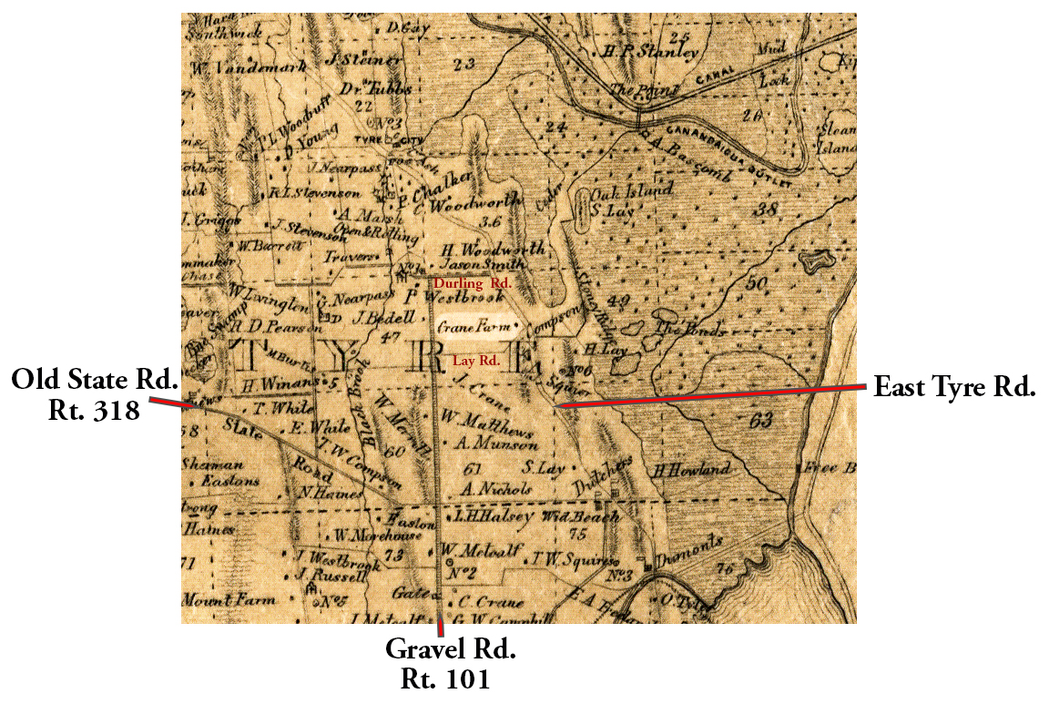 1850 Seneca County Tyr-6 Excerpt Map.jpg ¹ These three maps show the progression of ownership eventually to Pulaski Erastus Smith. The cobblestone residence was built in 1863 and the road locations have changed somewhat so the house is likely to the south of these 1850s map locations. | 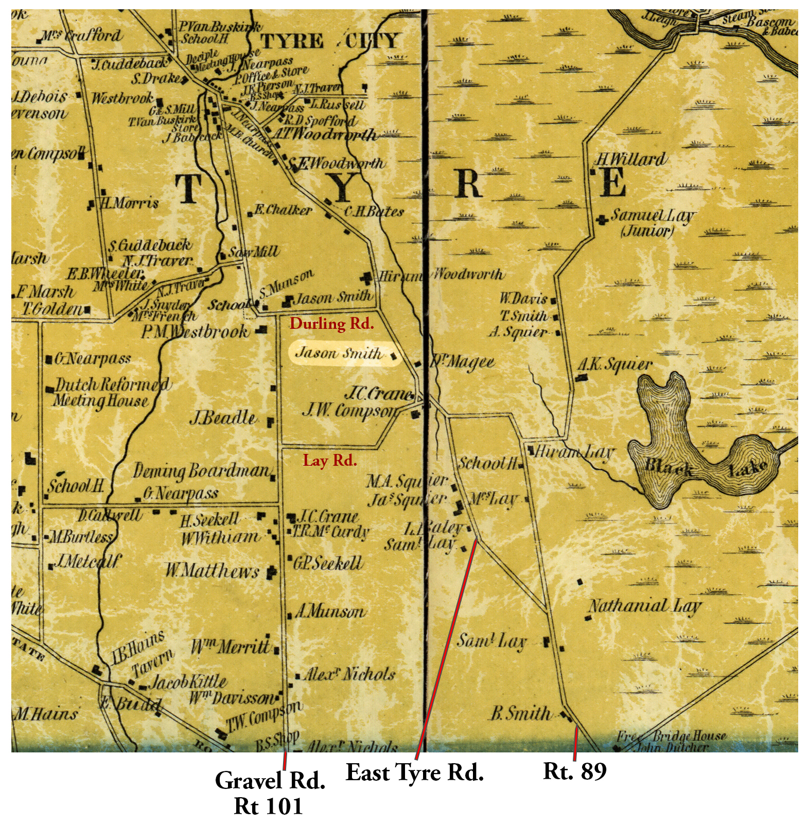 1852 Seneca County Tyr-6 Excerpt Map.jpg ² | 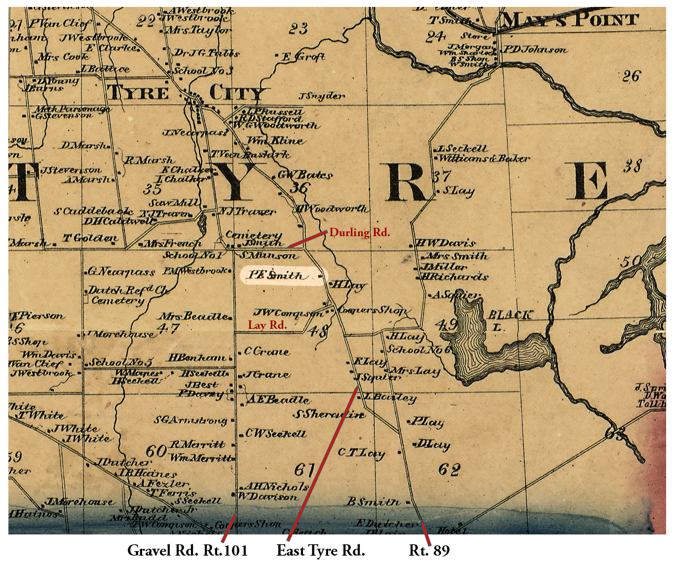 1859 Cayuga Seneca Tyr-6 Excerpt Map.jpg ³ | 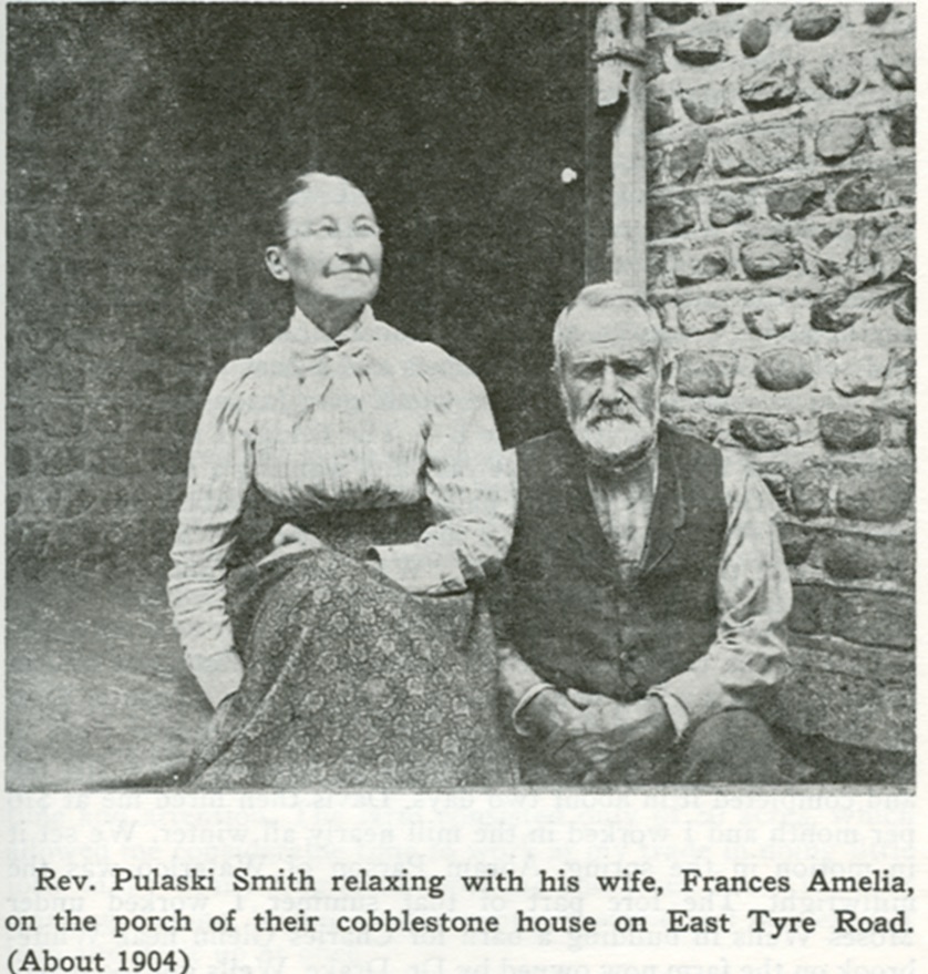 Pulaski E Smith House, Tyre.jpg ³ |
¹ 1850 Seneca County Map excerpt. Attribution not provided.
² 185? Seneca County Map excerpt courtesy Library of Congress. Editor's Note: An apparently incorrect 1838 date is printed on this map. The Library of Congress suggests "1858?"
³ 1859 Cayuga Seneca County Map excerpt courtesy Library of Congress.
